The forecast said 8 knots. It's 22 on the ground. Sound familiar?
Reading a wind forecast isn't complicated, but reading one correctly, in a way that actually tells you whether you're jumping today, takes a bit more than glancing at the BBC weather app and deciding the little wind icon looks friendly enough.
This guide breaks down exactly what to look for, what the numbers mean for skydiving specifically, and why the forecast on your phone is often lying to you.
Wind basics: what you're actually looking at
Every wind forecast gives you two things: speed and direction. Both matter. Neither one alone tells the full story.
Speed is measured in knots (nautical miles per hour) in aviation contexts, which is what you'll see on most skydiving-relevant tools. For reference:
| Knots | mph | What it means on a skydiving day |
|---|---|---|
| 0-5 | 0-6 | Dead calm. Make the most of it. |
| 5-10 | 6-12 | Standard conditions. Most canopies happy. |
| 10-15 | 12-17 | Starting to get sporty. Downsizers pay attention. |
| 15-20 | 17-23 | Often near or beyond student limits. Check your canopy. |
| 20-25 | 23-29 | Many DZs will begin restricting operations. |
| 25+ | 29+ | Ground day. Go to the wind tunnel. |
One thing before we go further: your DZ's limits and your canopy's limits are the final word, not any forecast guide. What's below is context, not clearance.
Direction is where it gets people. Wind direction is always stated as where the wind is coming from, not where it's going. A northerly wind blows from the north towards the south. Get this backwards and your mental picture of the landing pattern is already wrong.
Gusts are the number most people ignore and probably shouldn't. A forecast showing 12 knots with gusts to 22 is a fundamentally different day to a steady 12. Gusts represent the peaks in an otherwise variable wind, they hit fast, they can flip a canopy on approach, and they don't always show up well in headline forecasts. Always look for the gust value, not just the average.
Surface winds vs upper winds: the bit that actually matters for skydivers
Here's what most generic weather guides don't tell you: the wind at the surface and the wind at altitude are often completely different, different speeds, sometimes different directions entirely.
As a skydiver you're operating across multiple wind layers simultaneously:
- At exit altitude (10,000–15,000ft): This determines your aircraft's groundspeed and where you exit relative to the landing area. Upper winds at this altitude can easily be 30–50 knots even on a calm surface day.
- In freefall (roughly 5,000–15,000ft): You're moving through these wind layers whether you like it or not. They affect your track, your opening point, and how far you drift under canopy.
- Under canopy (0–5,000ft): Surface and low-level winds. This is what determines your landing pattern and approach.
- At the surface: What you feel when you're standing at the packing mat wondering if it's worth jumping.

The disconnect between these layers is why experienced jumpers don't just check one forecast. They look at multiple altitude levels and build a picture of the whole column.
The tools worth using
A good multi-altitude forecast tool is what most skydivers end up relying on, because it lets you visualise wind at different pressure levels across the whole column. Look for something that lets you toggle between 850hPa (typically around 4,000–5,000ft), 700hPa (roughly 10,000ft), and 500hPa (roughly 18,000ft) and shows the wind field in real time. The best tools run multiple forecast models , ECMWF and GFS being the main ones, and let you switch between them to see where they agree and where they don't. Disagreement between models is itself useful information: it means the forecast is uncertain and you should weight it accordingly.
XCWeather is less visually impressive but gives clean, readable wind data at multiple altitudes for UK locations. Good for a quick column check.
Windguru is the kitesurf and windsport crowd's tool of choice and it's excellent for surface and low-level wind forecasting. More granular than the BBC. Worth bookmarking.
The Met Office Mountain Forecast is underused by skydivers but genuinely useful. It forecasts wind at summit level for various mountain ranges, which, counterintuitively — gives you a decent proxy for upper winds in a way that's presented in plain English.
Your DZ's own tools: Most dropzones have a weather station on site and many post live wind readings. Skydive Langar, Hibaldstow, and a few others update their socials with current conditions. That live data is worth more than any forecast when you're trying to make a go/no-go call on the day.
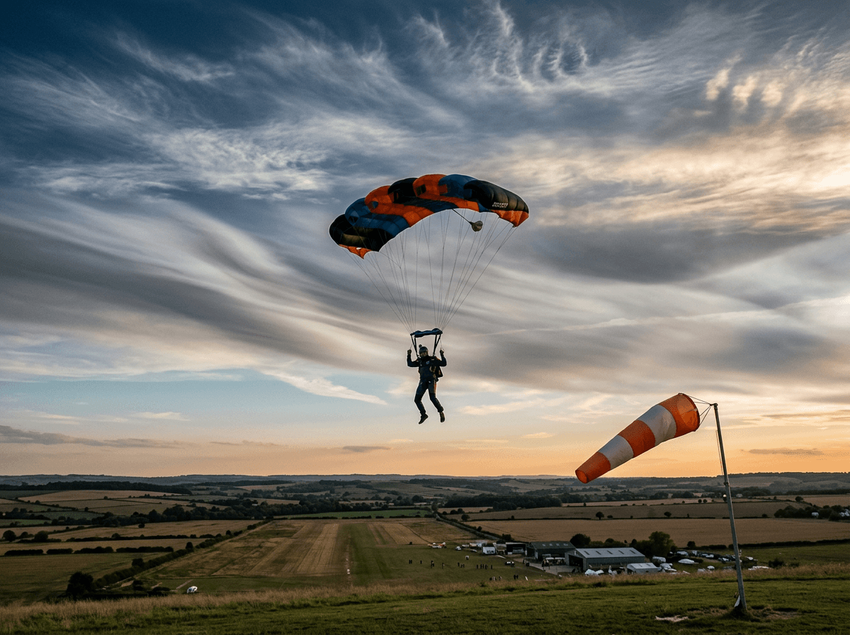
Reading a windsock
Every dropzone has one. Many jumpers treat it as decoration. It isn't.
A windsock tells you two things at a glance: wind direction and approximate wind speed. The sock extends in the direction the wind is blowing towards (the opposite of forecast convention, which is why people get confused). The angle it makes with the pole tells you the speed:
- Fully extended, horizontal: 15+ knots
- About 75° from the pole: ~12 knots
- About 45° from the pole: ~8 knots
- About 30° from the pole: ~5 knots
- Hanging limp: Calm — enjoy it

The windsock is measuring what's happening right now at the surface of your DZ. It doesn't tell you what's happening at altitude, and it doesn't tell you what's coming in the next hour. Use it alongside the forecast, not instead of it.
What to actually check before you jump
When you're building your wind picture for a jump day, work through this sequence:
1. Upper winds at exit altitude Check 700hPa on your forecast tool. Anything over 40 knots at exit altitude and your spot is going to be interesting. Over 60 knots and most aircraft won't want to run the door.
2. The mid-column (freefall layer) Check 850hPa. This is where you're spending most of your freefall. Strong winds here mean you'll drift further than expected under canopy if you don't account for it in your spot.
3. Surface forecast - speed and gusts Your DZ's limits and your own canopy limits. Know them before you arrive, not when you're about to board.
4. Wind direction consistency Is the wind coming from the same direction at all altitudes? If surface wind is southerly but upper wind is northerly, you've got wind shear. Not necessarily a deal-breaker but worth knowing, your canopy will experience a direction change on the way down.
5. The trend Is it building, dropping, or steady? A 15-knot forecast that's been dropping all morning is a different day to a 15-knot forecast that's been climbing since 8am.
A quick note for kiters and climbers
Kitesurfers are often better at reading wind forecasts than skydivers, they have to be, because their sport only works within a specific wind window. If you kitesurf, most of this will be familiar. The main difference is altitude: you care almost exclusively about the surface layer, but you care about it with a precision that most skydivers don't bother with. Windguru and a good surface forecast tool are your best friends.
Climbers care about wind primarily for temperature, summit conditions, and the risk of loose rock being blown off above you. The Met Office mountain forecasts are built for you. Check them.
The short version
- Wind direction is where it's coming from
- Always check gusts, not just average speed
- Surface wind and upper wind are often completely different - check both
- A multi-altitude forecast tool showing pressure levels is your most useful instrument
- The windsock tells you what's happening right now, not what's coming
- If two forecast models disagree, treat the day as uncertain
The next article in this series covers microclimates: why your weather app is confidently wrong about your specific DZ and what to use instead.
Got a question about reading forecasts? Feel free to message us about it. If you jump at a UK DZ with particularly predictable (or unpredictable) local weather patterns, we'd love to hear about it.